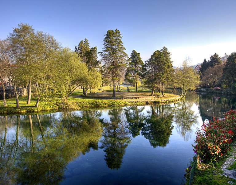
Seixas marina/ Minho river pier
Portos, Marinas, Docas e Pontões de Recreio
Entering the River Minho from the Atlantic Ocean:
The River Minho is navigable as far as Tui, about 30 kilometres from the mouth, but like all navigation, it is difficult due to changing depths and currents. The tides are felt about 40 kilometres upstream with a maximum tidal current of 4 knots and the difference between high and low tide at the mouth of the river to Tui is more than 1 hour.
Its bar at the river mouth is 1,400 metres wide between the tips of Santa Tecla in Spain and Ponta Ruiva in Portugal. It is very exposed to waves and winds from the west and especially the south-west. Only a small part of this bar is navigable.
Between these two points, about 0.2 miles west of Ponta Ruiva, in the middle of the mouth, lies the Ínsua de Santo Isidro, where the Ínsua Fort and a whole conglomeration of rocks and reefs are located. Next to the Ínsua Fort, to the north-west, stands the lighthouse which, with its three sectors, White, Red and Green, signposts the free and navigable zones, as well as the dangerous zone and the shallows. The sea is rough all along the bar, with strong swells.
Ínsua gives rise to two entrances to the river Minho:
Barra do Norte (Spanish coast) between Ínsua and Ponta Barbela the access is extremely complicated and currently blocked without the possibility of opening.
We'll enter the river Minho via Barra Sul, off the Portuguese coast, between the islet of Ínsua and Ponta Ruiva. Warning: the lack of signposted channels at this entrance means that if you want to enter, you should do so under the supervision of someone with a good knowledge of the area. If you don't, you should have up-to-date large-scale navigation charts.
The navigation instructions of the Caminha Maritime Police, whose signalling tower is located near Ponta do Cabedelo, must be followed. Failure to comply with the instructions is punishable by a fine of up to €2,000.
Navigation conditions on the Minho:
1º The variations in its flow are an average of 2 metres between high tide and low tide.
Take into account the time difference between high and low tide between Tui and Camposancos. High tide is normally between 1 hour 45 minutes and 1 hour and low tide is between 2 hours 50 minutes. In other words, if high tide in A Guarda is at 00:00 minutes, in Tui it will be at 01:45 minutes. If low tide in A Guarda is at 00:00 minutes, low tide in Tui will be at 02:00 minutes. 50 minutes approximately.
2º We recommend always sailing at medium or high tide to avoid running aground.
3º The current at low tide averages around 4 knots. At high tides and in some parts of the river, this speed can double. The incoming current averages 3 knots and, like the downstream current, can double at some points.
4º The maximum draught should not exceed 2.5 metres.
5º Don't trust the colour of the river water, it's very difficult to see if we have water or if there's a sandbank on our bow.
If in doubt, moderate your speed as much as possible and, in the case of an outboard motor, raise it to prevent it from sucking up sand.
The navigable stretch of the river Minho lacks a nautical chart and signposts. Navigation along the channel is by landmarks, and it is advisable not to disregard the numbers on the depth sounder. It is recommended to seek advice from specialists who know the river well.
For summer visitors, it is suggested that you make your first trips at high tide,
observing possible changes in the sandbanks and marking reference points to avoid them.
The route into the bar should follow these points:
Point 1: Departure from coordinates 41º51'17.9"North 008º 54'08.1"West.
This point corresponds to the observation of the line located on Moledo beach in Portugal.
From this point, we set a course of 099º and sailed 1.3 miles to the next point.
Point 2: Change of course at Moledo at coordinates 41º51'4"North 008º52'23.9"West. Our bearing is that of two towers with white and red stripes on the bow, located in Camposancos, on the Spanish coast. The course will be 10º, following the bearing and rectifying the course by the current. To the next point 1 mile from the point of change of course.
Point 3: Cabedelo at coordinates 41º52'5.32"North 008º52'08.51"West.
At the mouth of the river in front of the tip of Cabedelo, we changed our course to starboard towards the sand.
Point 4: Tongue of sand at coordinates 41°52'18.78"North 008º 51'51.55" West towards Bajo de Oliveiras, in Galicia.
Point 5: Bajo de Oliveiras at coordinates 41°52'49.64"North 8°51'3.02"West towards Pasaxe, in Galicia.
Point 6: Paxase at coordinates 41°53'22.32"North 8°50'49.34"West, towards Seixas, Caminha. In Seixas, stay close to the river bank.
Point 7: Seixas at coordinates 41°54'4.18"North 8°48'56.41"West.
Capitania do Porto de Caminha
Largo Pero Vaz n.º 2, 4910-167 Caminha
Tlf: +352258 100 320
Email: capitania.caminha@amn.pt
Web: https://www.cm-caminha.pt/
https://www.amn.pt/DGAM/Capitanias/Caminha/Paginas/capitania-do-porto-de-caminha.aspx
Junta de Freguesia de Seixas, Largo de São Bento, 4910-341Seixas
Tlf.: +351258 721 131
Caminha ( Viana do Castelo )
41.899246,-8.817184 (Ver mapa)

